Skip to content
Aviate

An intelligent planning and navigation app for pilots.

It reads everything about your flight before you do. While you fly, Aviate keeps an eye on everything so you can keep your hands on the controls.

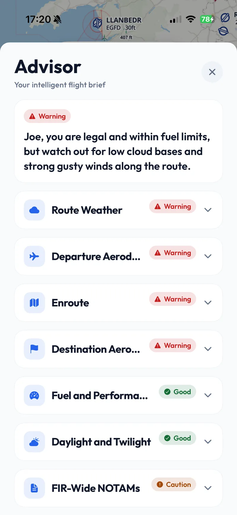
Aviate’s pre-flight brief on an iPhone. A red Warning chip sits over a summary reading “you are legal and within fuel limits, but watch out for low cloud bases and strong gusty winds along the route”, above a list of route weather, departure aerodrome, enroute, destination, fuel, daylight and NOTAM sections, each carrying its own status of warning, good or caution.
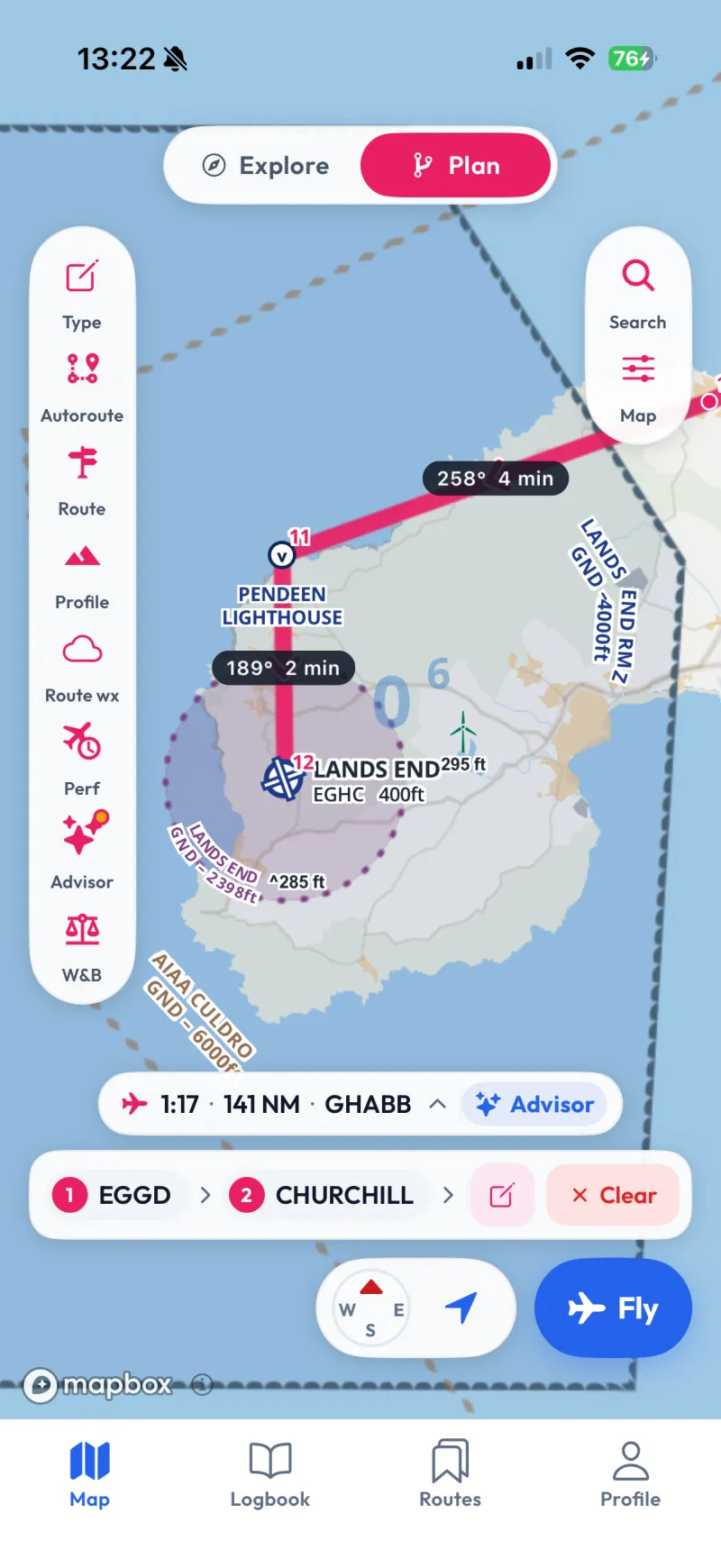
Plan mode on an iPhone: a route drawn from Bristol down to Land’s End with each leg labelled with its track and time, a toolbar of Type, Autoroute, Route, Profile, Route weather, Performance, Advisor and weight and balance, and a summary reading one hour seventeen, 141 nautical miles.
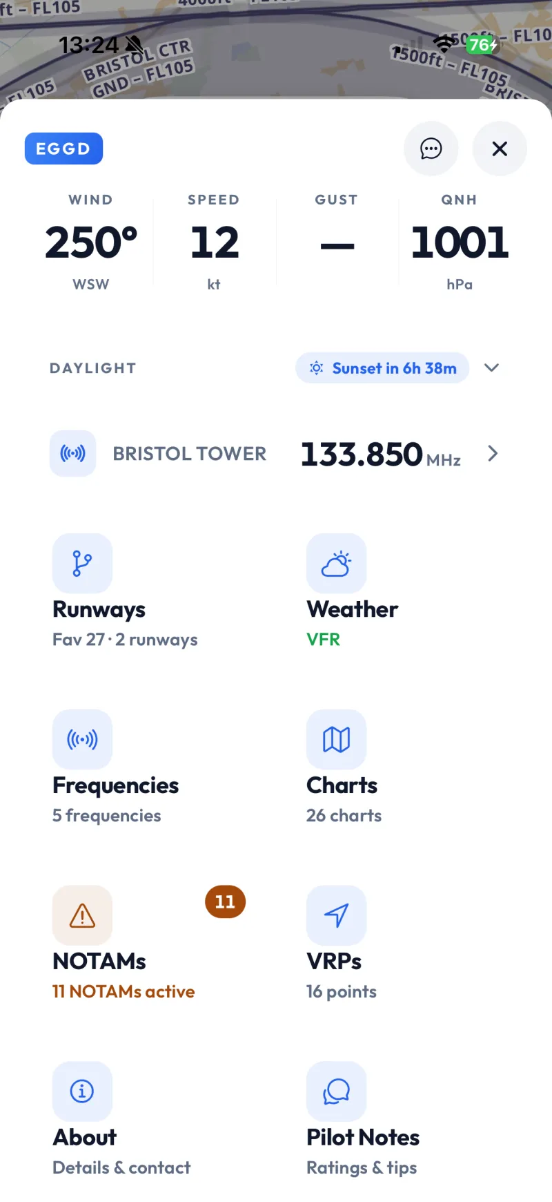
The airfield sheet for Bristol on an iPhone: wind 250 degrees at 12 knots and a QNH of 1001, sunset in six hours 38 minutes, Bristol Tower on 133.850, and cards for runways, weather reading VFR, five frequencies, 26 charts, eleven active NOTAMs and sixteen reporting points.
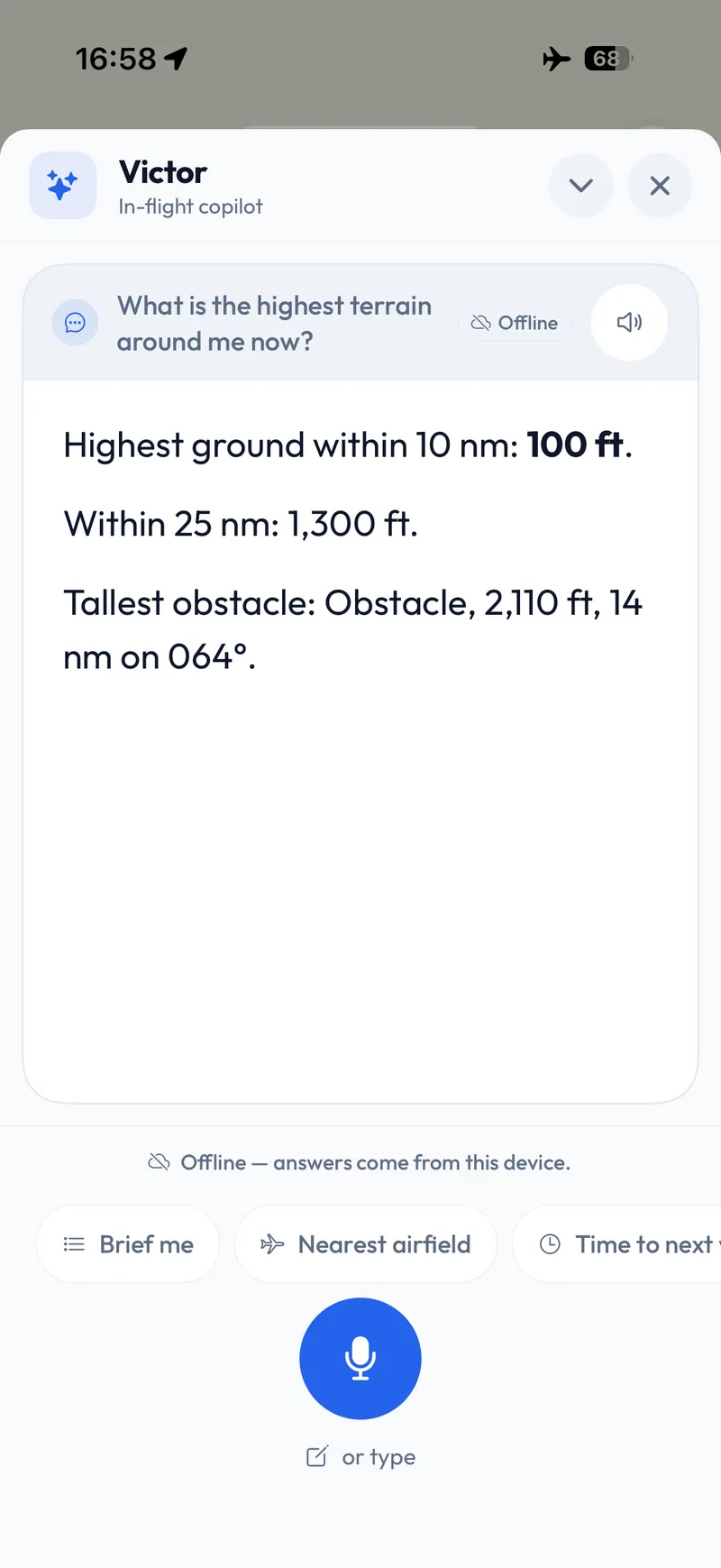
Victor on an iPhone in aeroplane mode. Asked “what is the highest terrain around me now?”, it answers that the highest ground within 10 nautical miles is 100 ft, within 25 nautical miles 1,300 ft, and the tallest obstacle is 2,110 ft, 14 nautical miles away on a bearing of 064 degrees. An Offline chip sits beside the question and a line under the answer reads “Offline — answers come from this device”.

Available across tablet and mobile.

Plan on a tablet's wider screen or on your phone. Your routes, your aircraft and your logbook are the same on both.
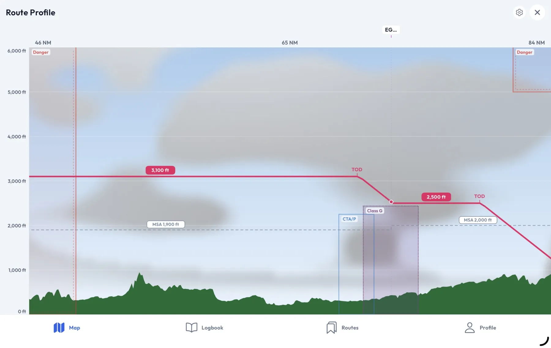
Aviate’s Route Profile on an iPad in landscape: a cross-section of a whole route with green terrain along the foot, forecast cloud above it, the planned track in red with its top of descent marked, the minimum safe altitude dashed across each leg, and the airspace the route crosses drawn as blocks at the altitudes it occupies.
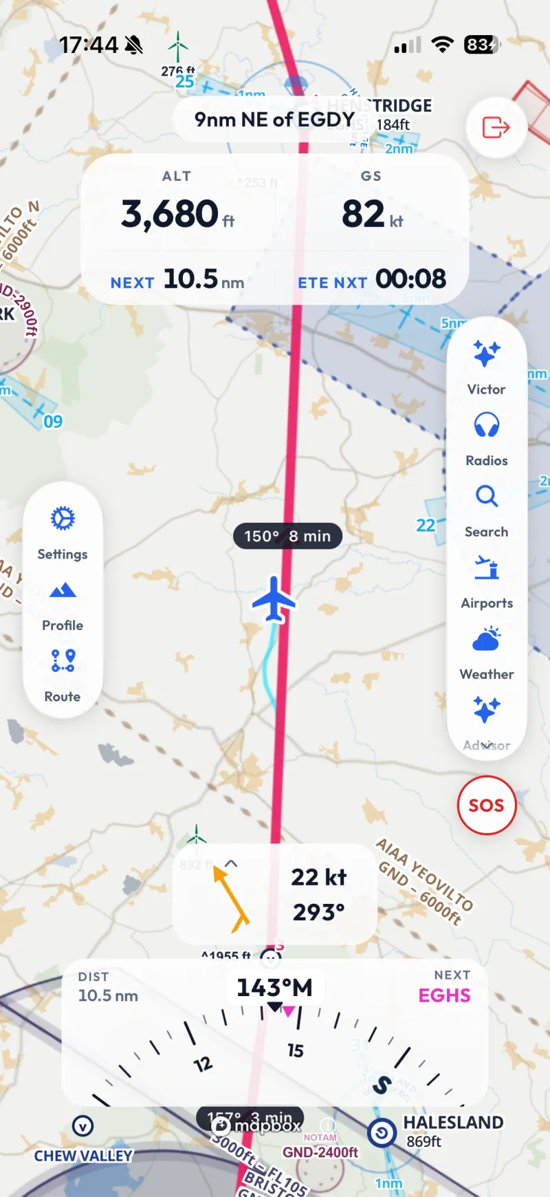
The same app in flight on an iPhone: altitude and ground speed set large across the top, the distance and time to the next waypoint under them, the wind, a heading strip, and the aircraft drawn on its track over a decluttered map.

iPhone and iPad

Android

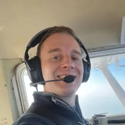
Joe Charman in the cockpit of a light aircraft, wearing a headset, with the wing strut and sky through the window behind.

Joe Charman

Founder of Aviate

I’m a UK Private Pilot and a software developer based in Wales, with a software development MSc from Swansea University. I wanted an intelligent flight bag to fly with, so I built one.

Join the Aviate waitlist

Aviate is in development, coming soon. Join the list for the odd note as we build, and one when it is ready.

Free to join, occasional useful updates by email